Offwell Wetland Survey
Areas within The
Wetland
Diagram of the Wetland Wetland Description Plant zonation in wetlands
The regions detailed below have been separated on the basis of the plant communities occurring there. Each region in the wetland is described with the aid of pictures and plant species lists. Click on the links below to go to pages dedicated to each specific area. |
|
|
|
|
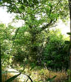
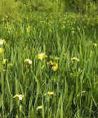
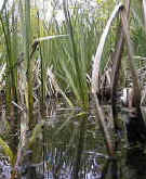
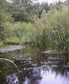
| Dry Land | Marsh | Swamp | Open Water |
| Area A usually dry | Area B 0-10cms | Area C emergent zone | Area D up to 1m deep |
| None of the four main regions defined above are totally uniform. Some parts of them may be significantly different. These are separated out below. | |||
| Area A2 Central Island Zone |
Area
B2 Marginal Marsh |
Area C2 Marginal stagnant standing water |
Area E Ponds within the marsh zone |