|
The Woodland Education Centre |
|
|
The Woodland Education Centre |
|
Ecological Survey Methods
| Two different methods were used to survey the vegetation on the Heathland
Restoration Project site. A belt transect was carried out and random quadrats were
also sampled.
|
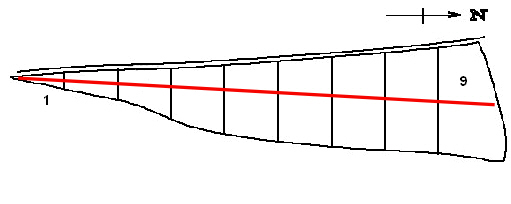 |
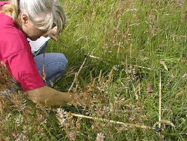
Belt transect The site was surveyed in July by sampling at intervals along a transect line (a rope marked at 1m intervals) laid across the centre of the site, from the southern boundary of section 1 across to the northern boundary of section 9. |
| A 0.5 m2 quadrat
(a square frame measuring 0.5m on each side) was placed on the ground every 2m along the
line. The plant species inside the quadrat were identified, their % cover was estimated
and their maximum height noted. This type of survey is called a belt transect, because it measures species abundance across a narrow band (similar to a belt). In addition to the belt transect, a general survey was also carried out to note other plant species occurring outside the transect area.
For the belt transect method, quadrats were surveyed every other metre along the line in each section. An equivalent number of random quadrats were sampled in the top of each section. This was repeated for the bottom section of each strip. As a result, twice the number of random samples were taken in each strip overall compared to the belt transect. The two sets of results together cover all areas of the heathland site and give a good picture of alterations in the vegetation cover of the site. |
>> Continue to Plant species list and abundance by section
Ecological Survey 2001 |